About the project
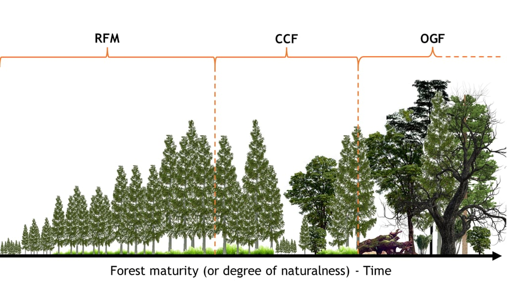

Fig. 1. Reference framework for forest maturity. Ranging from low (RFM, rotation forest management), intermediate (CCF, continuous cover forestry) and high (OGF, old-growth) degrees of maturity.
While conventional forest inventories are costly and time-consuming, using remote sensing technologies like terrestrial laser scanning (TLS) and satellite data (e.g. aerospace radar technology, Fig. 2) can can greatly expand the scale and frequency of monitoring. To achieve this, I will need to develop models to map key forest indicators such as deadwood, large trees, and structural complexity.
This work will enable more efficient, large-scale monitoring and supports decision-making for conservation and forest management. This is where my research comes in, focused on improving methods for monitoring forest maturity, specifically in Norway spruce forests in the Czech Republic.
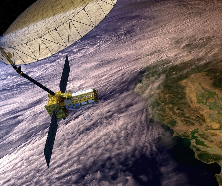

Fig. 2. The NASA-ISRO Synthetic Aperture Radar (NISAR) mission is a joint project between NASA and ISRO to co-develop and launch a dual-frequency syntheric aperture radar on an Earth observation satellite in 2025.
Forests play a critical role in biodiversity and climate regulation. My research focuses on the "forest maturity gradient", which measures the naturalness of forests, ranging from intensively managed systems to untouched old-growth forests (Fig. 1). Understanding this gradient is crucial for implementing sustainable forest management practices and preserving biodiversity, particularly as outlined in the EU Forest Strategy for 2030.
Co-funded by the European Union (MERIT - Grant Agreement No. 101081195)
Views and opinions expressed are, however, those of the authors only and do not necessarily reflect those of the European Union or the Central Bohemian Region. Neither the European Union nor the Central Bohemian Region can be held responsible for them.


MERIT is a postdoctoral fellowship programme for incoming mobility for researchers from all over the world. It is supported by the HORIZON EUROPE programme, co-funded by the MSCA-COFUND grant, the Regional Government and the Hosting organizations budgets.
